Ground Conditions
What Miami houses sit on: limestone, marl, muck, and fill
Foundation behavior follows the ground, and the ground in Miami-Dade is unusual enough that most national advice does not transfer. This is what the geological and soil survey data says about the county, and what each layer means for a building sitting on it.
Miami-Dade is geologically young, flat, wet, and made almost entirely of calcium carbonate. There is no bedrock in the sense a New Englander would recognize, no clay in the sense a Texan would, and no depth of soil in the sense most of the country takes for granted. What there is instead is a shallow, irregular limestone surface, a thin cover of marl and sand, extensive organic soils where the ground was wet, and a great deal of imported fill wherever people needed the ground to be higher than it was.
The Miami Limestone
The rock under most of the developed eastern county is the Miami Limestone, a Pleistocene formation roughly 130,000 years old. Its oolitic facies, made of tiny rounded carbonate grains cemented together, forms the ridge; a bryozoan facies sits further west under the Everglades. Freshly quarried it is soft enough to cut with hand tools, which is why so much early Miami construction used it directly as building stone.
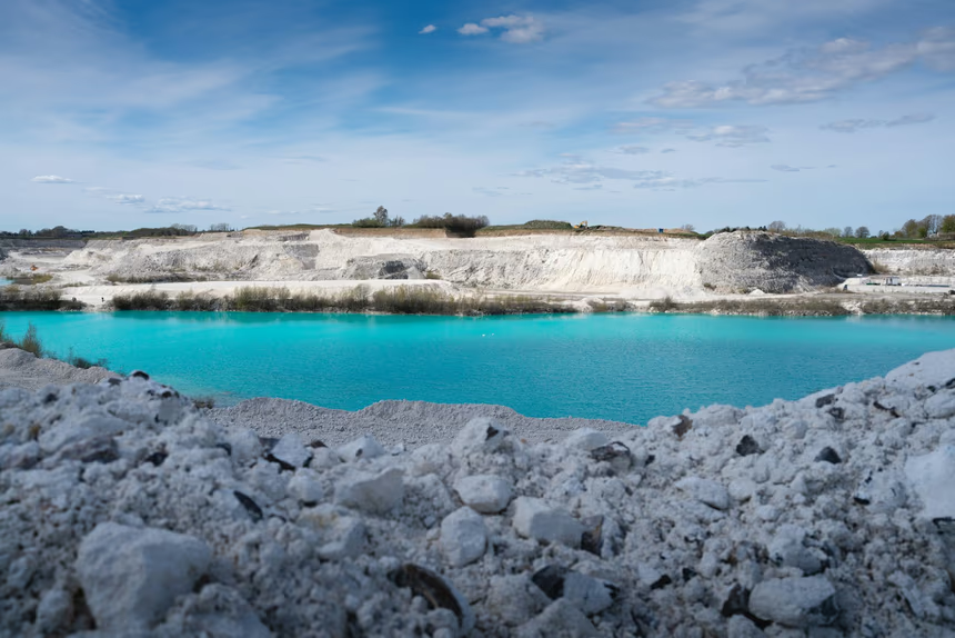
Two properties matter structurally. The first is thickness. USGS mapping records the formation at about ten feet or less across much of eastern Miami-Dade, exceeding thirty feet only along the Atlantic Coastal Ridge, and reaching a maximum of about sixteen feet in the west of the county. It is a veneer, not a mass. The second is that USGS describes it as riddled with secondary solution holes that are commonly partly or completely filled with lime mud and sand. Water dissolving limestone over tens of thousands of years leaves voids, and those voids fill with soft sediment. A footing landing on one is bearing on mud, not rock, and it will not behave like its neighbor twenty feet away.
The Miami Rock Ridge
The ridge is the strip of higher limestone ground running roughly parallel to the coast. Miami-Dade County describes it as extending south and west from North Miami Beach to Long Pine Key in Everglades National Park, and it is where the county's older urban development sits, because it was the only dry ground. USGS puts it at two to ten miles wide, forming the highest ground in the county at eight to fifteen feet above sea level between Homestead and north Miami, exceeding twenty feet in places, with only five to eight feet west of Homestead.
For comparison, the same source puts the Everglades at three to nine feet, the coastal marsh and mangrove fringe at zero to three feet, and the Sandy Flatlands at six to eighteen feet. The county's entire vertical range is about twenty feet. Being on the ridge is favorable for foundations, because rock tends to be shallow, but it does not guarantee anything about a specific footing.
One caution: not every neighborhood people associate with the ridge sits high on it. Downtown and Brickell are on low ground near the river mouth, and the ridge runs behind them. Elevation on a particular parcel is worth checking rather than assuming from the neighborhood name.
Marl, muck, and organic soils
Over and beside the rock sits a thin cover of marl and sand, and where the ground was persistently wet, organic soil. USDA soil survey data for Miami-Dade records Histosols, the order covering muck and peat, at roughly 107,000 acres, about sixteen percent of the county's area. The series are names most residents will not recognize but the soil surveyors will: Shark Valley, Cooper Town, Macks Camp, Tamiami on the freshwater side, and Keylargo muck on the tidal side.
Organic soil is the problem child of foundation engineering. It has very low bearing capacity, it holds enormous quantities of water, and it keeps compressing under load for decades rather than reaching equilibrium in a season. Where a neighborhood was built by filling over ground like this, the fill and the material under it both continue to consolidate, and buildings on them settle slowly and unevenly for a very long time.
Fill
A great deal of built Miami-Dade sits on imported material. The soil survey classifies more than 33,000 acres as Udorthents, the classification for human-transported and disturbed material, with the largest map units being Udorthents with a limestone substratum complexed with urban land, and Udorthents complexed with water and urban land. That is the technical description of a county that raised itself to buildable grade.
Fill is not inherently a problem. Fill placed in thin lifts, compacted, and density-tested makes perfectly good bearing material, and plenty of Miami-Dade sits on exactly that and always has. Fill that was pushed in and levelled is a different substance entirely, and the two are indistinguishable from the surface twenty years later. The difference shows up as settlement, which is the only reason anyone ever finds out which one they have.
The water table
The Biscayne Aquifer under southeast Florida is shallow, unconfined, and among the most permeable aquifers in the world. Readings taken from USGS groundwater monitoring wells inside the City of Miami during the 2026 wet season put the water table roughly two to eight feet below grade depending on site elevation, with lower-lying wells at the shallow end. Dry season levels sit lower.
Three consequences follow. Nobody builds basements. Excavation below a couple of feet usually means dealing with water. And because the ground is so permeable, water moves through it freely, which is why a leaking supply line under a slab can carry away a surprising volume of fine material before anything appears at the surface, and why tidal cycling can affect soil well back from a seawall. Water, not soil chemistry, is the main agent of foundation movement in this county. That case is made in full in the guide to water, drainage, and your slab.
What is not here: expansive clay
The soil survey settles this with numbers. Across Miami-Dade County, the maximum linear extensibility recorded for any soil horizon is 5.2 percent, and the county-wide average across more than 900 horizons is 0.18 percent. No Vertisols and no vertic subgroups are mapped anywhere in the county, and no components carry smectitic mineralogy. The dominant series, Krome, Biscayne, Perrine, are carbonatic and their official descriptions call them nonplastic.
Shrink-swell soil is the primary driver of residential foundation repair across much of the United States. In Miami-Dade it is effectively absent. If a diagnosis for a house here rests on clay movement, it is a diagnosis borrowed from somewhere else.
What follows from all this is a short list of realistic causes and a short list of repairs that address them, both covered in the main Miami foundation guide and in the underpinning methods guide.
Get a free quote
Call (786) 841-1091 or send the quote form. Describing what you are seeing costs nothing, and so does the written quote that follows.
Questions on this
How deep is the limestone under my house?
Is my house on fill?
Why does Miami not have basements?
Sources
- USGS Water-Resources Investigations Report 90-4108, Fish and Stewart, on Dade County geology, ridge elevations, and Miami Limestone thickness.
- USDA NRCS Soil Data Access, Miami-Dade County Area survey (FL686), for soil orders, acreage, linear extensibility, and Udorthents.
- USGS Water Services, groundwater levels at City of Miami monitoring wells.
- Miami-Dade County on the Miami Rock Ridge and pine rockland.